







The project will map over 1000 stops and make use of the Crowdsorsa mobile game app, which has been employed in Helsinki to map crosswalks and traffic lights.
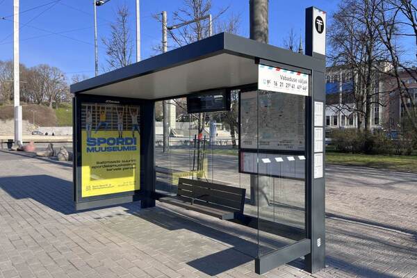
Tallinn is using a network of volunteers to map public transport stop accessibility. The volunteers will assist in mapping and photographing over a thousand public transport stops in the Estonian capital.
The project makes use of the Crowdsorsa mobile game app, which has been employed in Helsinki to map crosswalks and traffic lights.
The Tallinn Accessibility Information System, created in 2020 and available at lips.tallinn.ee, is designed for people with special needs to help them better plan their daily transport. Although the system already includes information on public transport stops, the data needs updating.
“Improving accessibility is one of Tallinn’s priorities and, to achieve this, it’s essential to gather accurate and current information about the condition of our transport stops. Volunteer contributions are vital in helping us reach our goal of a more accessible city for all,” said deputy mayor Karl Sander Kase.
According to Jako Stein, senior specialist at Tallinn’s Welfare and Healthcare Department, individuals simply need to download the free Crowdsorsa mobile app, create a user account, and select the Tallinn public transport stop survey. “Be sure to carefully read the instructions before starting, then begin photographing and uploading pictures of the stops,” added Stein.
Participants in Crowdsorsa can earn a reward of one euro per stop photographed, provided the stop hasn’t already been photographed by someone else.
Crowdsorsa CEO Toni Paju explained that all submitted photos are reviewed to ensure they meet requirements: “The map application shows which stops have already been photographed and where unphotographed stops remain.”
“Volunteer contributions are vital in helping us reach our goal of a more accessible city for all”
The goal is to gather images for all 1,088 public transport stops in Tallinn. Based on the photos, the project will assess accessibility elements, such as tactile features for the visually impaired or high kerbs that impact wheelchair users.
The mapping project is organised by the Tallinn Welfare and Healthcare Department in collaboration with selected contractors, Riesa Consultative Oy and Finnora Oy (Crowdsorsa), which have previously used similar methods in Helsinki to map crosswalks and sound-equipped traffic lights.
Why not try these links to see what our SmartCitiesWorld AI can tell you.
(Please note this is an experimental service)
How does the Crowdsorsa app ensure accuracy in mapping transport stops?What accessibility features are assessed from the photos of stops?How do volunteer contributions impact Tallinn’s transport accessibility goals?What role do contractors play in the Tallinn mapping project?How is updated stop data integrated into the Tallinn Accessibility Information System?